| San Francisco Bay | San Quentin to Alcatraz |
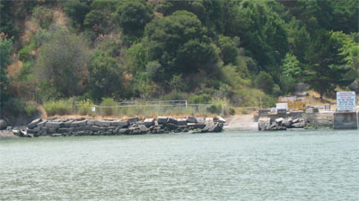
San Quentin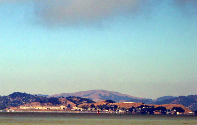
Franciscan padres founded the mission at San Rafael in 1817 and had converted (or enslaved) over half of the local Miwok population by 1824 when serious resistance (or terrorism) developed. One Petaluma militant, Quintun, was caught on the long peninsula south of San Rafael. When Mexico got independence from Spain, the missions were stripped of their land and accordingly, the Punta de Quentin land grand was given to Juan B Cooper by the Mexican governor in 1840. By the time of the gold rush and annexation by the US, map makers were so used to the Spanish custom of naming things after saints, they tossed in the "San". In 1852, the State commissioners selected it over Goat and Alcatraz islands which were already claimed by the Federal government to be the site of a state prison. Accordingly, the hull of the Waban was towed to the point and filled with prisoners whose first job was to build the prison. For more click here. Today, the prison is often the site of protests for and against the imposition of the death penalty which is exclusively carried out here. Mount Tamalpais 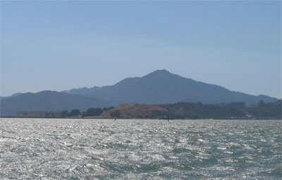
Coastal Miwok Indians lived in the area for thousands of years before Europeans arrived. In 1770, two explorers named the mountain La Sierra de Nuestro Padre de San Francisco, which was later changed to the Miwok word Tamalpais. The meaning of the word is unclear but may be from the Miwok words for "coast" and "mountain". The legend that describes the mountain's long ridgeline is the "Sleeping Maiden Legend," from the Miwok people. It tells how a young Miwok girl was saved from a rival tribe by the shuddering mountain. Afterward her reclining profile could be seen in the mountain's contour. In 1896, The Mill Valley and Mt. Tamalpais Scenic Railway was created for the purpose of building a railway over the top of Mt. Tamalpais to Bolinas. The railway never made it to Bolinas but was never the less a great success despite the omission. The big attraction were the "gravity" cars which were loaded with people at the top of the hill and would coast down for nearly an hour. The "Crookedest Railroad in the World" never recovered from a wildfire and was abandoned in the Great Depression. Some great pictures here.
Originally acquired by the Navy as a coaling station in 1904 which provided fuel for the Pacific Fleet including the "Great White Fleet" of Teddy Roosevelt in 1908. In the 1930's, suspension cables for the Golden Gate bridge were spun here before being barged to the bridge site. It was latter briefly the site of what is now the California Maritime Academy which moved to its current campus in Vallejo in 1940. When the war came, the site was used to build the 7 miles of netting hung across the Gate. The massive anchors for these nets became bulkheads protecting the shoreline. More history here and info on the current tenant, SAN FRANCISCO STATE UNIVERSITY'S MARINE LABORATORY here.
South Hampton Shoals 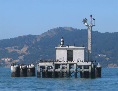
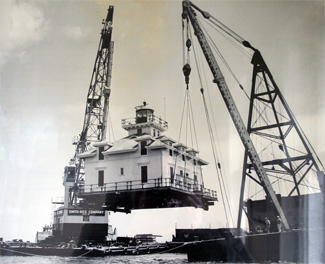
Southampton Shoals is a two miles long hazard to navigation which is now marked by a small concrete platform supporting an automated light, a diaphone horn and a great number of birds. In 1905, a three-story Victorian Lighthouse was built. In 1906, the earthquake knocked the station a little off level but the lighthouse remained in operation until 1960. The top two stories of the lighthouse were barged up the delta to Tinsley Island where they are used as a clubhouse by the St. Francis Yacht Club. The lens from the lighthouse is on Angel Island near the ferry landing.The platform is supported by some of the original pilings. Pictures and more here. |
| ©2002-6 Accidental Cruiser | Home • Islands • Photo Journal • Cruising Log • Sailing Info • Viewer's Comments • Comment |